

Project Overview
Our innovative system leverages cutting-edge computer vision technology to transform how urban environments manage waste. By identifying litter hotspots and providing actionable analytics, TrashScan enables more efficient resource allocation and cleaner public spaces.
Watch Demo
Pilot Study Deployment
Real-World Application
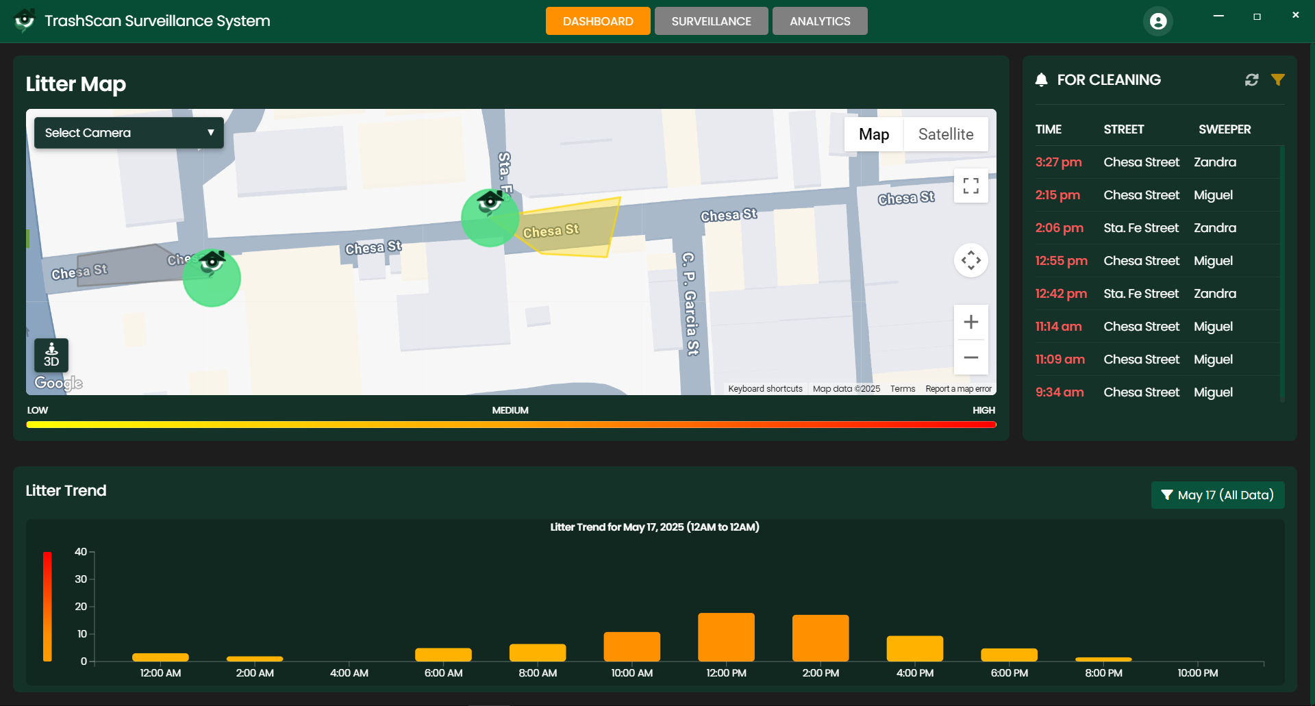
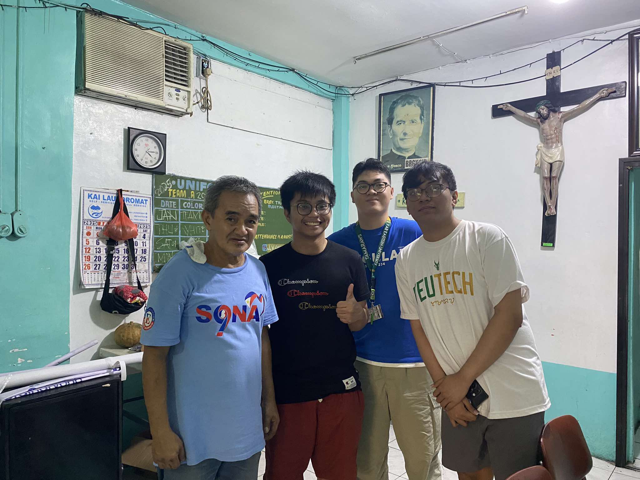
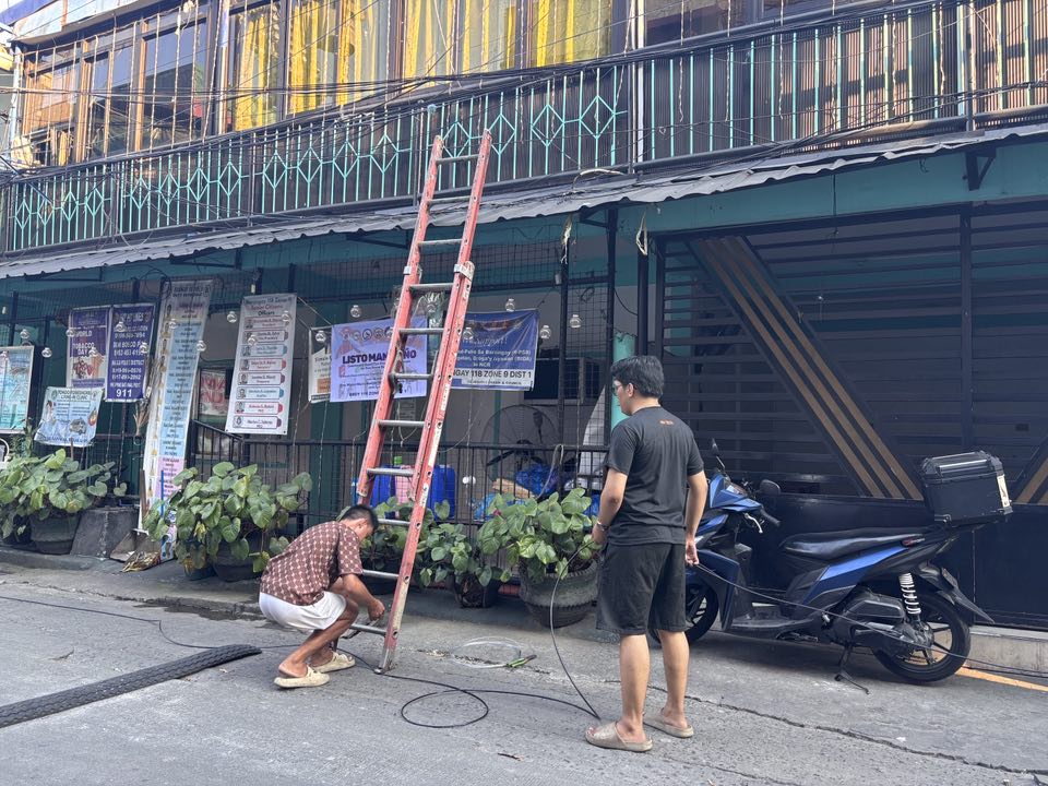
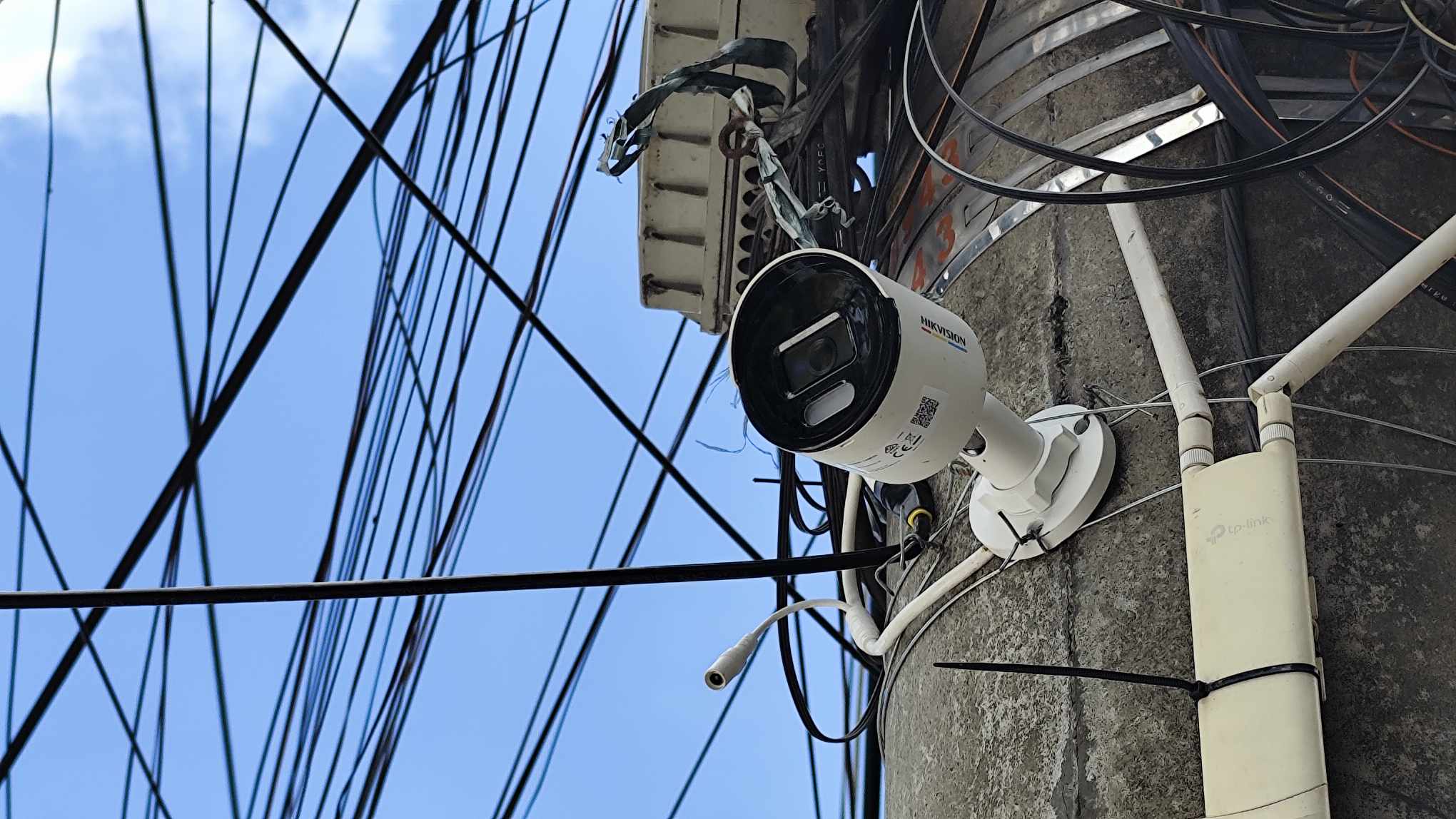
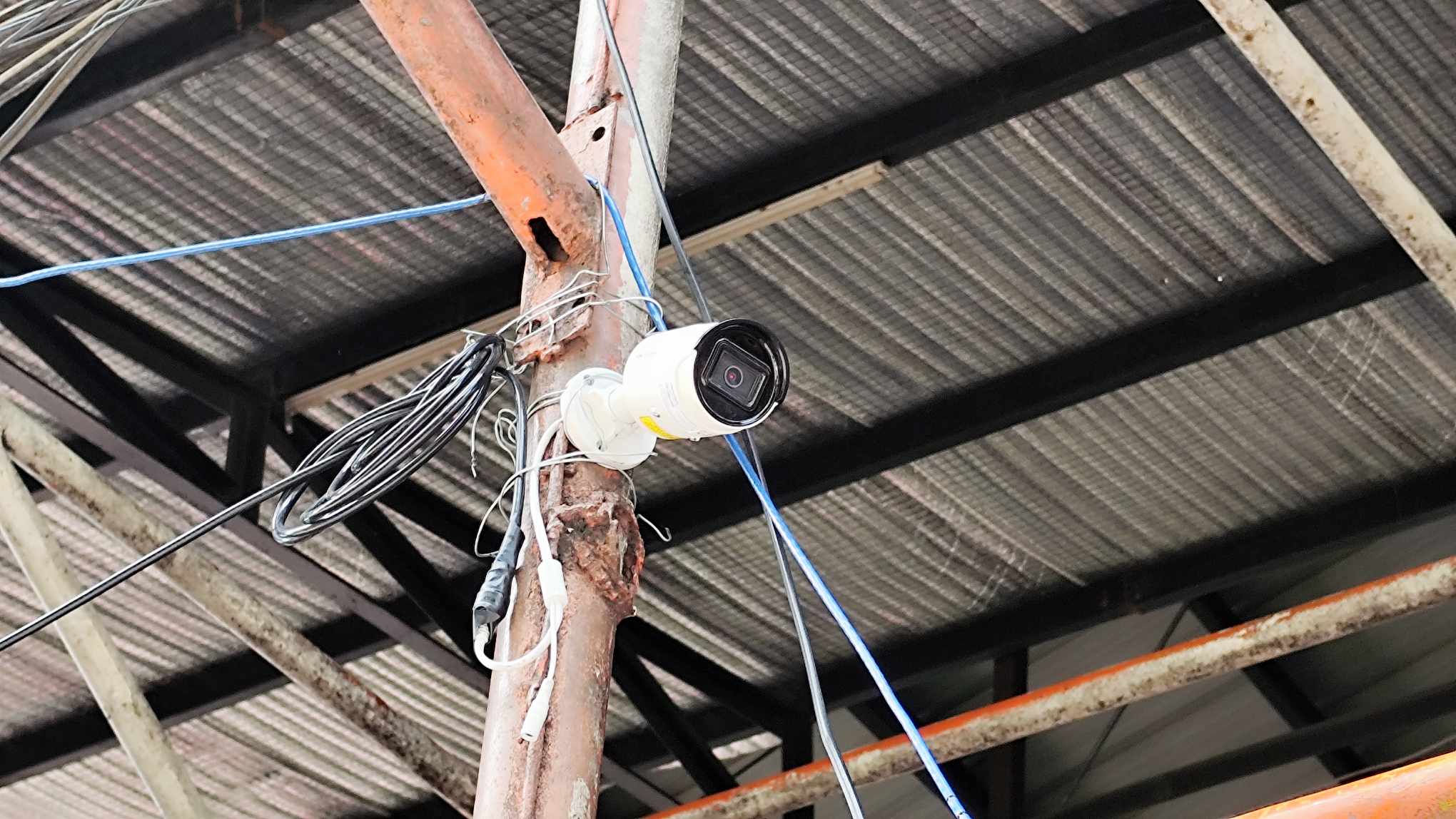
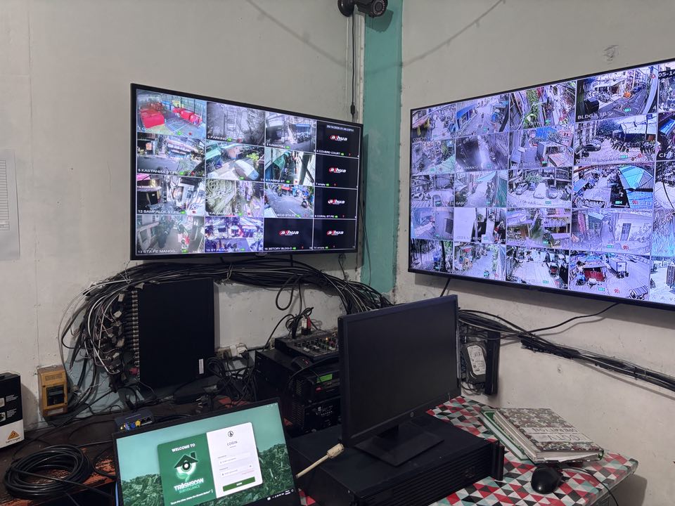
We successfully deployed TrashScan in Brgy 118 Zone 9, Tondo Manila for a one-week pilot study to demonstrate its effectiveness in a real urban environment. The system monitored key streets, identified litter hotspots, and provided actionable data to local authorities.
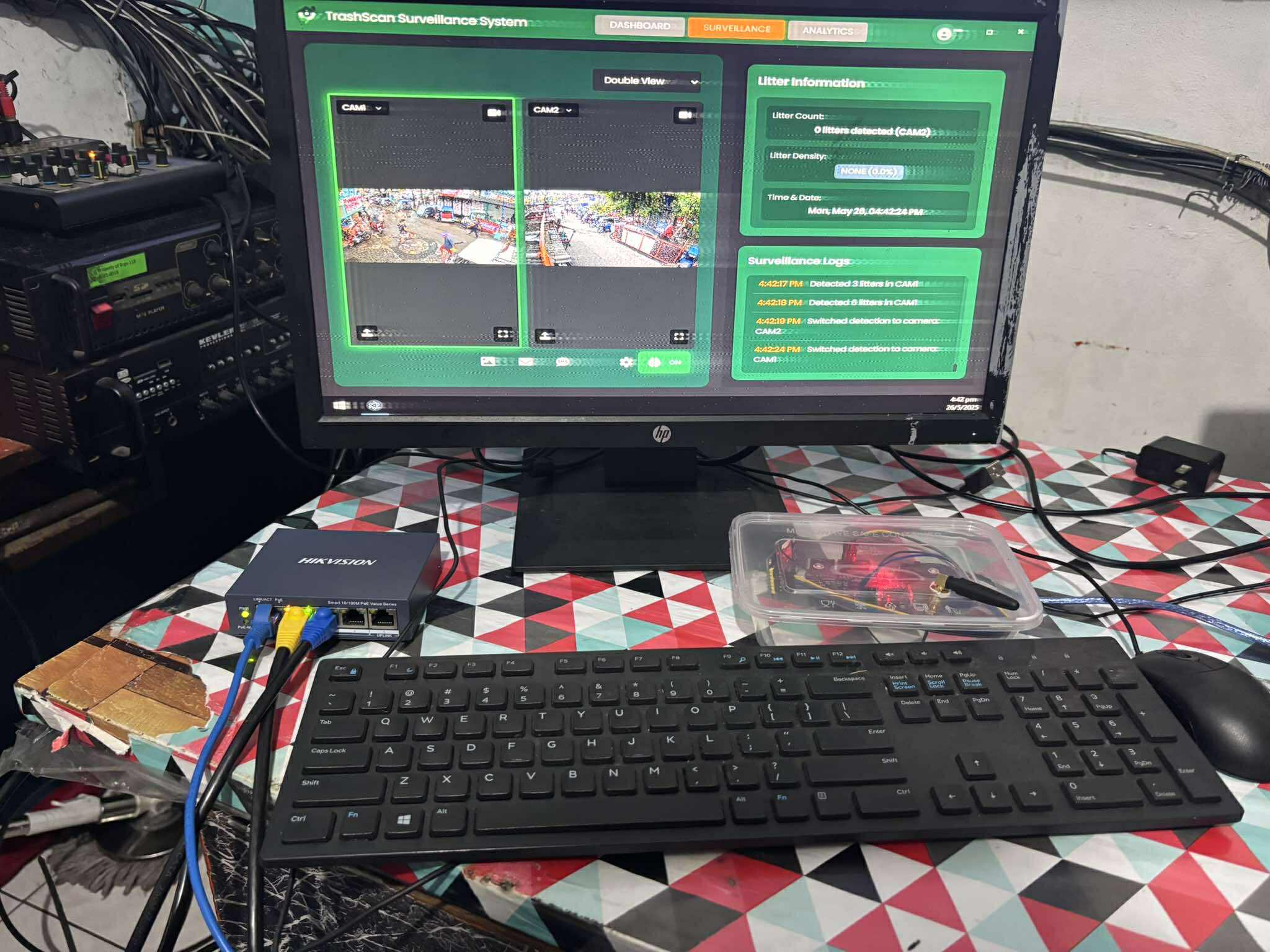
CCTV Integration
Connected to existing surveillance infrastructure
Data Collection
Gathered valuable insights on litter patterns and density
Community Engagement
Collaborated with local officials and sanitation workers
Key Features
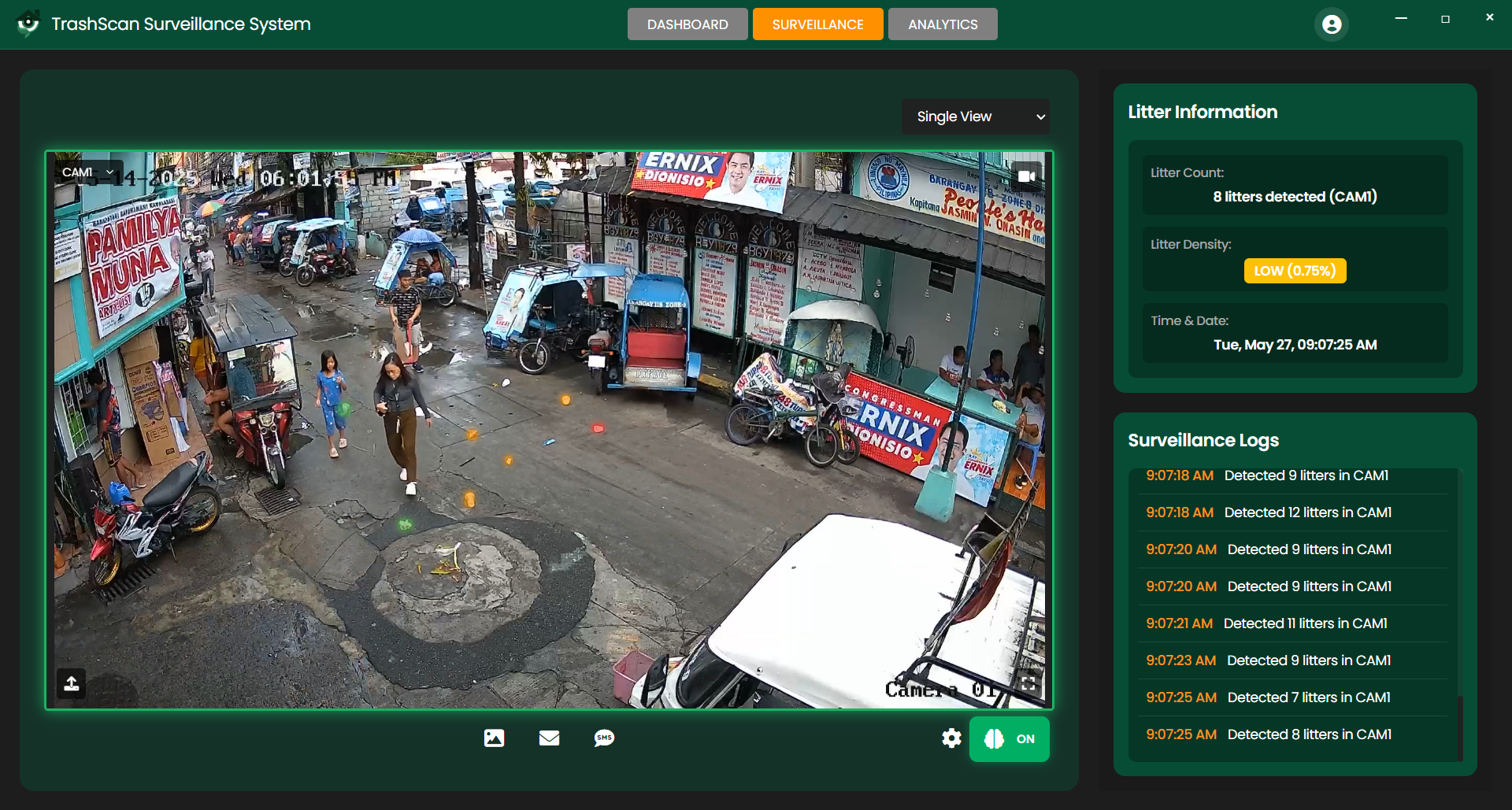
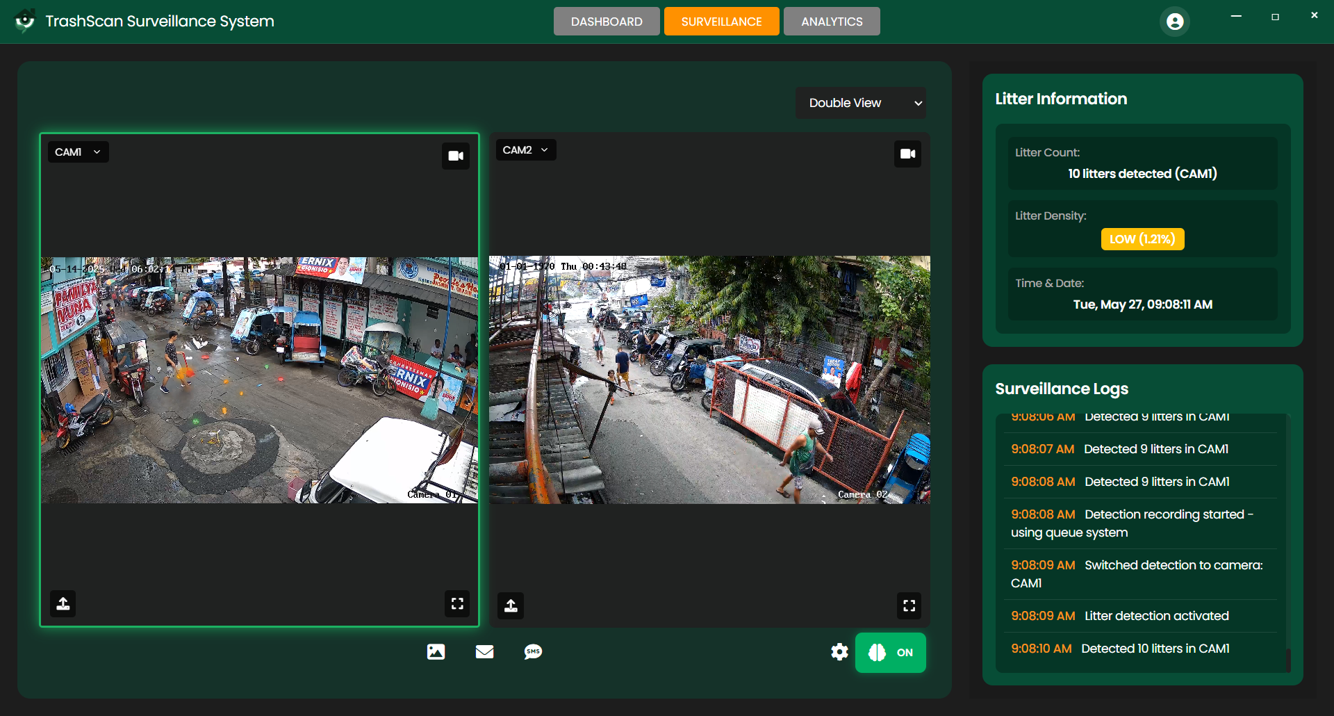
Real-time Detection
AI-powered litter detection using YOLOv8 with existing CCTV infrastructure.
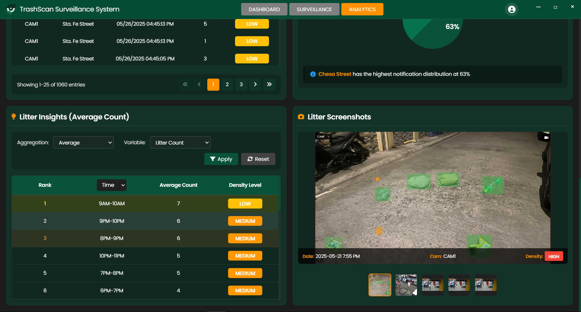
Density Heatmaps
Visual representation of litter concentration across monitored areas.
Alert System
Automated notifications when litter accumulation exceeds defined thresholds.
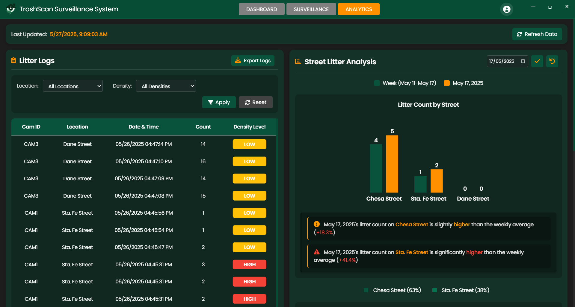
Analytics Dashboard
Comprehensive data visualization and reporting tools for informed decision-making.
Data Logging
Historical tracking of litter patterns and cleanup effectiveness over time.
Screenshot Tools
Capture and document litter instances for reports and evidence collection.
System Architecture
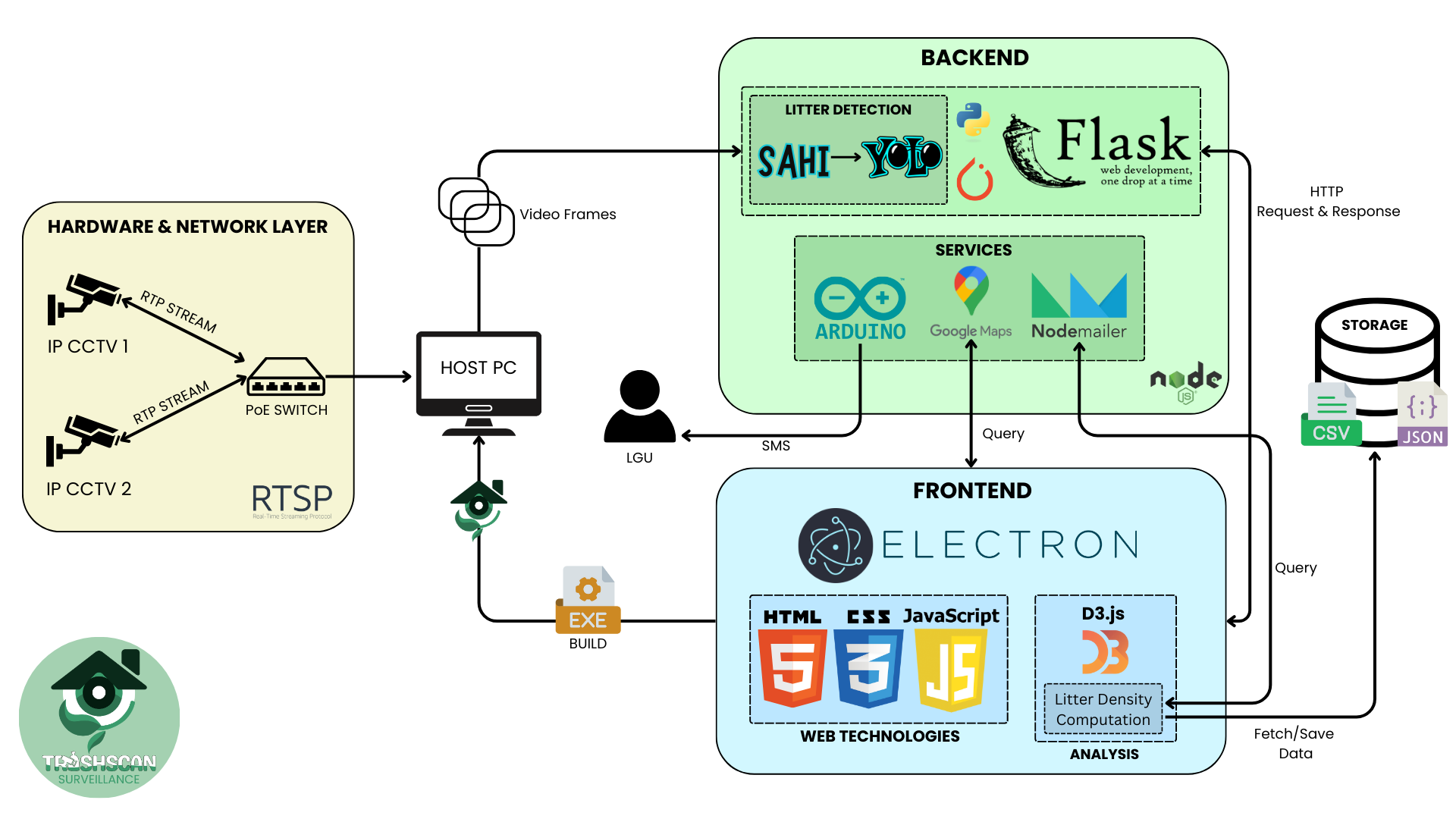
TrashScan connects to existing CCTV infrastructure, processes live feeds with object detection models, and visualizes data on an interactive dashboard.
CCTV cameras capture live video footage from city streets
AI algorithms process the video to detect and classify litter
Data is analyzed and stored in the central database
Interactive dashboard presents actionable insights
How It Works
Video Capture
Cameras capture video feeds from streets
AI Detection
Frames are extracted and passed to a trained detection model (YOLOv8 + SAHI)
Analysis
Detected litter is counted and analyzed for density
Visualization
A heatmap and litter density chart are generated in real time
Notification
If density exceeds thresholds, notifications are sent to LGUs & sweepers
Technology Stack
Frontend
Backend
Database & Storage
Visualization Tools
Purpose and Goals
TrashScan was developed to address the growing challenges of urban waste management in busy metropolitan areas. Our system aims to:
- Improve waste response efficiency by identifying priority areas
- Support urban cleanliness initiatives with real-time monitoring
- Reduce manual street monitoring costs and labor requirements
- Assist LGUs and MMDA in data-driven cleanup planning
- Create cleaner, more sustainable urban environments
Our Vision
Cleaner streets through smarter technology
Our Mission
Empower communities with AI-driven waste management solutions
Target Users
Local Government Units
City planners and municipal authorities responsible for urban cleanliness
Waste Management Departments
Teams managing collection routes and resource allocation
Street Sweepers
Front-line workers responsible for maintaining clean public spaces
Urban Planners & Researchers
Professionals studying waste patterns to improve city design
System Requirements
Minimum Requirements
- Intel Core i3
- 8GB RAM
- 2GB VRAM GPU
- Windows 10
Recommended Specs
- Intel Core i5 or better
- 16GB RAM
- GTX 1050 or better GPU
- Windows 10/11
Additional Requirements
- Access to IP cameras
- Minimal internet connection
- RTSP streaming capability
Compliance & Ethical Considerations
Privacy Protection
TrashScan avoids facial recognition and private property monitoring
Public Spaces Focus
Only operates on public roads and visible waste
Regulatory Compliance
Complies with local data protection and government guidelines
Responsible Use
Promotes responsible use of surveillance for environmental management
Future Roadmap
Our Vision for Expansion
Cloud Integration
Integration with LGU databases and cloud services
Mobile Application
Mobile app for real-time litter alerts to LGUs and sweepers
Advanced Capabilities
Integrating litter classification and littering violation detection
Policy Support
Long-term trend analysis for policymaking support
Meet Team AGILE
A passionate group of developers committed to creating innovative solutions for urban challenges.

Jansen Jhoel G. Moral
Project Manager / AI&ML Developer / Full Stack Developer

Dane Ross B. Quintano
Backend Developer / Database Developer / Documentation

John Christian S. Paglinawan
Frontend Developer / UI&UX Designer / Documentation

Dharmveer S. Sandhu
QA Analyst / Data Analyst

Cristen Lei D. Tolentino
Graphic Designer

Justine Jude C. Pura
Thesis Adviser